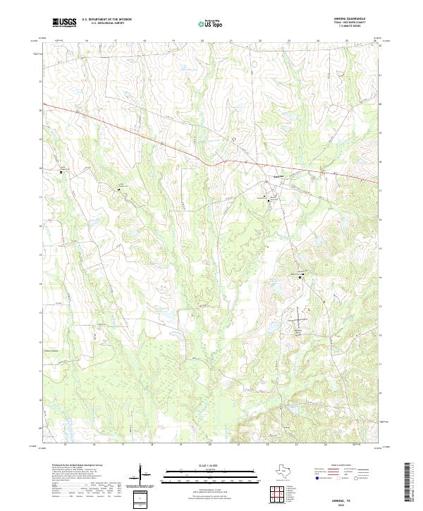
2022 Map of Annona
USGS Topo · Published 2022About this map
The town of Annona sits at the heart of this Red River County landscape, a region defined by a intricate network of creeks and small local lakes. Grounded in rural Texan life, the map reveals a community structured around its spiritual and familial history, featuring several historically significant burial grounds including Annona Cem, Lanes Chapel Cem, and the Rock of Ages Cem. The southern portion of the map is dominated by the broad drainage of White Oak Oak Cr and its associated wetlands, while the northwest is marked by the distinct open terrain of Peters Prairie.
Find a feature on this map
65 named features on this map. Tap any name to fly to it.
Don’t see what you’re looking for? This feature index may not catch every label — zoom into the map to look around manually.
Map Details
Editions of this 2022 Annona Map
This is the sole edition of this map. No revisions or reprints were ever made.
Other maps of this area

1950 · White Rock
USGS Topo · 1:24,000

1950 · Annona
USGS Topo · 1:24,000

1951 · English
USGS Topo · 1:24,000

1951 · Annona
USGS Topo · 1:24,000

1951 · White Rock
USGS Topo · 1:24,000

1951 · Avery
USGS Topo · 1:24,000

1953 · Texarkana
USGS Topo · 1:250,000

1956 · Texarkana
USGS Topo · 1:250,000

1964 · Cuthand
USGS Topo · 1:24,000
1964 · Dimple
USGS Topo · 1:24,000