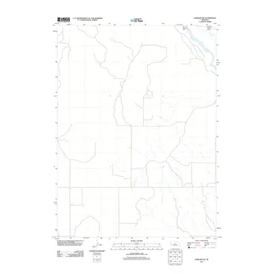
2011 Map of Anselmo NE
USGS Topo · Published 2011About this map
The Middle Loup River winds through the northeast corner of this landscape, defining the hydrology of the Custer County region. This corridor is characterized by the Milburn Diversion Dam and the associated Rankin Ditch, features that reflect the systematic management of water for Nebraska's agricultural interior. Near the river, the McMillan Ranch and a nearby Airport mark the human footprint on a terrain otherwise dominated by the natural drainage patterns of the Sandhills. These labels provide a record of ranching operations and water infrastructure as they existed in the early twenty-first century, offering a specific look at the rural development along the river's path.
Find a feature on this map
5 named features on this map. Tap any name to fly to it.
Don’t see what you’re looking for? This feature index may not catch every label — zoom into the map to look around manually.
Map Details
Editions of this 2011 Anselmo NE Map
This is the sole edition of this map. No revisions or reprints were ever made.
Other maps of this area

1951 · Lillian
USGS Topo · 1:24,000

1951 · Anselmo
USGS Topo · 1:24,000

1951 · Anselmo SW
USGS Topo · 1:24,000

1951 · Anselmo NE
USGS Topo · 1:24,000

1951 · Anselmo NW
USGS Topo · 1:24,000

1951 · Milburn
USGS Topo · 1:24,000

1952 · Almeria SW
USGS Topo · 1:24,000

1952 · Brewster SE
USGS Topo · 1:24,000

1952 · Brewster SW
USGS Topo · 1:24,000

1955 · Broken Bow
USGS Topo · 1:250,000