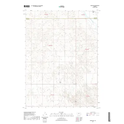
2017 Map of Anselmo NE
USGS Topo · Published 2017About this map
The Middle Loup River winds through the northeastern corner of this Custer County landscape, where the Sandhills terrain begins to drop into structured drainage systems. This 2017 survey by the U.S. Geological Survey illustrates the transition from the high, undulating tablelands to the more dissected valley floor. Human activity is sparse and defined by large-scale ranching and irrigation, evidenced by the Mc Millan Ranch Airport and the Rankin Ditch near the Blaine County line. The southern portion of the map is defined by significant topographical relief, including the namesake River Canyon and the neighboring Cedar Canyon. Access across these ranching lands is maintained by a network of rural routes such as River Canyon Rd and Columbia Table Rd, which trace the high ridges and canyon floors.
Find a feature on this map
16 named features on this map. Tap any name to fly to it.
Don’t see what you’re looking for? This feature index may not catch every label — zoom into the map to look around manually.
Map Details
Editions of this 2017 Anselmo NE Map
This is the sole edition of this map. No revisions or reprints were ever made.
Other maps of this area

1951 · Lillian
USGS Topo · 1:24,000

1951 · Anselmo
USGS Topo · 1:24,000

1951 · Anselmo SW
USGS Topo · 1:24,000

1951 · Anselmo NE
USGS Topo · 1:24,000

1951 · Anselmo NW
USGS Topo · 1:24,000

1951 · Milburn
USGS Topo · 1:24,000

1952 · Almeria SW
USGS Topo · 1:24,000

1952 · Brewster SE
USGS Topo · 1:24,000

1952 · Brewster SW
USGS Topo · 1:24,000

1955 · Broken Bow
USGS Topo · 1:250,000