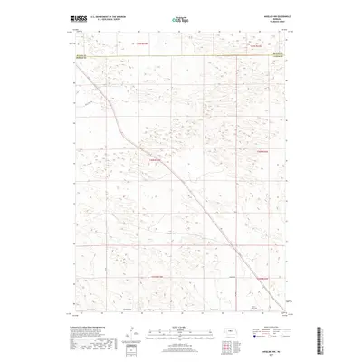
2017 Map of Anselmo NW
USGS Topo · Published 2017About this map
Grand View Cem sits in the southeastern corner of this quadrangle, serving as a primary point of interest for genealogists tracing local lineage in Custer County. The landscape is defined by the ephemeral flow of Rifle Cr and a grid of rural roads that navigate the complex topography along the Blaine Co and Custer Co border. A distinct network of transit lines, including Rifle Creek Rd and Hoosier Valley Rd, connects the scattered farmsteads and agricultural plots characteristic of the Nebraska sandhills region. The map captures the quiet, rural infrastructure of the early 21st century, where routes like Pioneer Rd and Grandview Rd provide the essential framework for a community organized by section lines and township boundaries such as t20n r23w and t21n r22w.
Find a feature on this map
18 named features on this map. Tap any name to fly to it.
Don’t see what you’re looking for? This feature index may not catch every label — zoom into the map to look around manually.
Map Details
Editions of this 2017 Anselmo NW Map
This is the sole edition of this map. No revisions or reprints were ever made.
Other maps of this area

1948 · Linscott
USGS Topo · 1:62,500

1950 · Linscott
USGS Topo · 1:62,500

1951 · Dunning
USGS Topo · 1:62,500

1951 · Anselmo
USGS Topo · 1:24,000

1951 · Anselmo SW
USGS Topo · 1:24,000

1951 · Anselmo NE
USGS Topo · 1:24,000

1951 · Anselmo NW
USGS Topo · 1:24,000

1952 · Brewster SE
USGS Topo · 1:24,000

1952 · Brewster SW
USGS Topo · 1:24,000

1954 · North Platte
USGS Topo · 1:250,000