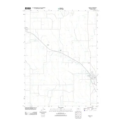
2011 Map of Ansley
USGS Topo · Published 2011About this map
Mud Creek meanders through the heart of Custer County, defining the agricultural character of this central Nebraska landscape. The settlement of Ansley serves as a primary hub in the southeast, situated near the Ansley Reservoir and the Ansley Park Dam. To the northwest, the smaller community of Berwyn is anchored by the Berwyn Post Office and Hazlett St. This 2011 survey captures the rural layout of the region, where wide-open spaces like Goose Valley are interspersed with significant local landmarks. For those researching family history in the area, the map precisely locates Janesville Cemetery and Ansley Cemetery, providing essential spatial context for 19th- and 20th-century burials. The presence of Elk Creek in the southwest corner further illustrates the drainage patterns that have long dictated land use and settlement in this portion of the Great Plains.
Find a feature on this map
16 named features on this map. Tap any name to fly to it.
Don’t see what you’re looking for? This feature index may not catch every label — zoom into the map to look around manually.
Map Details
Editions of this 2011 Ansley Map
This is the sole edition of this map. No revisions or reprints were ever made.
Other maps of this area

1951 · Broken Bow NE
USGS Topo · 1:24,000

1951 · Westerville
USGS Topo · 1:24,000

1951 · Ansley
USGS Topo · 1:24,000

1951 · Broken Bow SE
USGS Topo · 1:24,000

1951 · Ansley NE
USGS Topo · 1:24,000

1951 · Eddyville NE
USGS Topo · 1:24,000

1951 · Mason City NW
USGS Topo · 1:24,000

1951 · Mason City
USGS Topo · 1:24,000

1951 · Ansley SE
USGS Topo · 1:24,000

1955 · Broken Bow
USGS Topo · 1:250,000