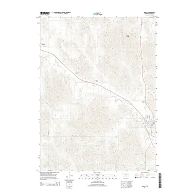
2014 Map of Ansley
USGS Topo · Published 2014About this map
Mud Cr meanders southeast across the central Nebraska landscape, defining the local geography as it flows through Goose Valley toward the settlement of Ansley. This 2014 survey documents the enduring layout of small communities in Custer County, anchored by the transportation corridors of Us-183 and Ne-2 Ne-92. To the northwest, the smaller village of Berwyn marks a quiet pocket of the county, connected to the larger hub of Ansley by the historical path of the railway and modern roads. The map reveals the placement of essential local landmarks, including the Janesville Cem located on a rise overlooking the valley and the Ansley Cem north of the town center. The presence of Ansley Reservoir and the drainage patterns near Comer Canyon provide insight into how water management and natural terrain have shaped agriculture and settlement in this part of the state.
Find a feature on this map
22 named features on this map. Tap any name to fly to it.
Don’t see what you’re looking for? This feature index may not catch every label — zoom into the map to look around manually.
Map Details
Editions of this 2014 Ansley Map
This is the sole edition of this map. No revisions or reprints were ever made.
Other maps of this area

1951 · Broken Bow NE
USGS Topo · 1:24,000

1951 · Westerville
USGS Topo · 1:24,000

1951 · Ansley
USGS Topo · 1:24,000

1951 · Broken Bow SE
USGS Topo · 1:24,000

1951 · Ansley NE
USGS Topo · 1:24,000

1951 · Eddyville NE
USGS Topo · 1:24,000

1951 · Mason City NW
USGS Topo · 1:24,000

1951 · Mason City
USGS Topo · 1:24,000

1951 · Ansley SE
USGS Topo · 1:24,000

1955 · Broken Bow
USGS Topo · 1:250,000