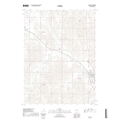
2017 Map of Ansley
USGS Topo · Published 2017About this map
Ansley serves as a primary hub for this Custer County landscape, where the grid of town streets like Main St, Keene St, and Nile St meets the industrial line of the Burlington Northern Santa Fe railroad. The terrain is defined by the winding course of Mud Cr and the broad depressions of Goose Valley, punctuated by the localized drainage of Comer Canyon to the northeast. Near the settlement of Berwyn, the landscape transitions from these natural features to a rural network of section roads like N Berwyn Rd and Rd 795. Genealogists will find the Ansley Cem and the more remote Janesville Cem to be significant landmarks for tracing local family histories within the township boundaries of T16N and T15N.
Find a feature on this map
44 named features on this map. Tap any name to fly to it.
Don’t see what you’re looking for? This feature index may not catch every label — zoom into the map to look around manually.
Map Details
Editions of this 2017 Ansley Map
This is the sole edition of this map. No revisions or reprints were ever made.
Other maps of this area

1951 · Broken Bow NE
USGS Topo · 1:24,000

1951 · Westerville
USGS Topo · 1:24,000

1951 · Ansley
USGS Topo · 1:24,000

1951 · Broken Bow SE
USGS Topo · 1:24,000

1951 · Ansley NE
USGS Topo · 1:24,000

1951 · Eddyville NE
USGS Topo · 1:24,000

1951 · Mason City NW
USGS Topo · 1:24,000

1951 · Mason City
USGS Topo · 1:24,000

1951 · Ansley SE
USGS Topo · 1:24,000

1955 · Broken Bow
USGS Topo · 1:250,000