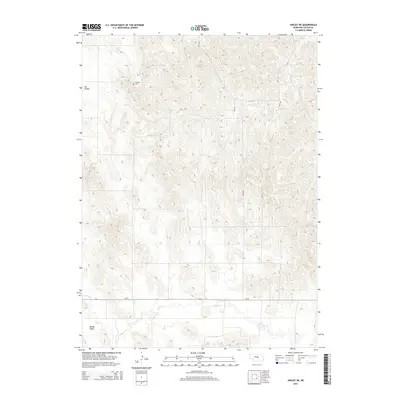
2014 Map of Ansley NE
USGS Topo · Published 2014About this map
Swanson Cem sits on a northern ridge within this pocket of Custer County, overlooking a landscape defined by the drainage patterns of Spring Cr and Clear Cr. The area is characterized by significant topographical relief, notably at Dry Valley in the northwest and Moody Valley to the south. This terrain transitions into a more structured grid in the southern portion of the map where Ne-70 cuts across the plains. The 2014 survey documents the rural character of this central Nebraska region, where the interplay between elevated plateaus and carved creek beds remains the primary feature. Genealogists may find value in the specific location of the Swanson Cem, which serves as a solitary landmark among the undulating hills and valleys of this ranching and agricultural territory.
Find a feature on this map
6 named features on this map. Tap any name to fly to it.
Don’t see what you’re looking for? This feature index may not catch every label — zoom into the map to look around manually.
Map Details
Editions of this 2014 Ansley NE Map
This is the sole edition of this map. No revisions or reprints were ever made.
Other maps of this area

1951 · Westerville
USGS Topo · 1:24,000

1951 · Ansley
USGS Topo · 1:24,000

1951 · Ansley NE
USGS Topo · 1:24,000

1951 · Arcadia West
USGS Topo · 1:24,000

1951 · Ansley SE
USGS Topo · 1:24,000

1951 · Arcadia SW
USGS Topo · 1:24,000

1952 · Sargent SE
USGS Topo · 1:24,000

1952 · Comstock
USGS Topo · 1:24,000

1952 · Sargent SW
USGS Topo · 1:24,000

1955 · Broken Bow
USGS Topo · 1:250,000