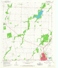
1965 Map of Anson
USGS Topo · Published 1967About this map
Anson serves as the focal point of this Jones County survey, revealing the town's mid-century layout with its central Courthouse, Library, and Hospital. The residential core is flanked by an Athletic Field and the High Sch, while the municipal infrastructure extends to Sewage Disposal Ponds on the eastern edge. Beyond the town limits, the landscape transitions into agricultural and resource-rich territory, marked by several Oil Well sites and Gravel Pits.
Find a feature on this map
25 named features on this map. Tap any name to fly to it.
Don’t see what you’re looking for? This feature index may not catch every label — zoom into the map to look around manually.
Map Details
Editions of this 1965 Anson Map
This is the sole edition of this map. No revisions or reprints were ever made.
Other maps of this area

1891 · Anson
USGS Topo · 1:125,000

1893 · Roby
USGS Topo · 1:125,000

1893 · Anson
USGS Topo · 1:125,000

1954 · Big Spring
USGS Topo · 1:250,000

1954 · Abilene
USGS Topo · 1:250,000

1957 · Hawley
USGS Topo · 1:62,500

1957 · Noodle
USGS Topo · 1:62,500

1958 · Big Spring
USGS Topo · 1:250,000

1958 · Abilene
USGS Topo · 1:250,000

1965 · Tuxedo
USGS Topo · 1:24,000