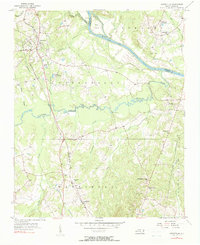
1956 Map of Ansonville
USGS Topo · Published 1990About this map
The Pee Dee River carves the northern border of this mid-century landscape, separating the townships of Anson and Richmond. The Winston-Salem Southbound railroad serves as the primary transit corridor, cutting north-south through the settlement of Ansonville. This area is characterized by a dense network of local landmarks, including the Rosenwald Sch, a significant indicator of the era's rural education infrastructure.
Find a feature on this map
40 named features on this map. Tap any name to fly to it.
Don’t see what you’re looking for? This feature index may not catch every label — zoom into the map to look around manually.
Map Details
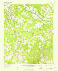
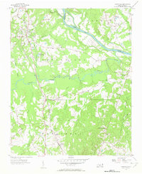
Editions of this 1956 Ansonville Map
Other maps of this area

1941 · Spartanburg
USGS Topo · 1:250,000

1942 · Troy
USGS Topo · 1:125,000

1942 · Rockingham
USGS Topo · 1:125,000

1953 · Florence
USGS Topo · 1:250,000

1953 · Raleigh
USGS Topo · 1:250,000

1953 · Spartanburg
USGS Topo · 1:250,000

1953 · Charlotte
USGS Topo · 1:250,000

1954 · Charlotte
USGS Topo · 1:250,000

1954 · Florence
USGS Topo · 1:250,000

1954 · Raleigh
USGS Topo · 1:250,000