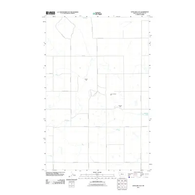
2011 Map of Antelope Flat
USGS Topo · Published 2011About this map
The Teton River cuts through the northern reaches of this High Plains landscape, where the wide open terrain of Chouteau County is defined by extensive agricultural flats and drainage networks. The area's nomenclature reflects its pioneer ranching and farming heritage, with large landforms such as Leepers Flat and Antelope Flat dominating the central topography. Water management is a critical component of this semi-arid environment, evidenced by the Leepin' Antelope Dam and the waters of Antelope Lake. A rigid grid of rural roads, including Sodbuster Rd, Promised Land Rd, and Davis School Rd, facilitates access to these remote sections. These names provide a window into the era of early 20th-century settlement and the persistent cultural legacy of the families who worked this corner of Montana.
Find a feature on this map
17 named features on this map. Tap any name to fly to it.
Don’t see what you’re looking for? This feature index may not catch every label — zoom into the map to look around manually.
Map Details
Editions of this 2011 Antelope Flat Map
This is the sole edition of this map. No revisions or reprints were ever made.
Other maps of this area

1886 · Great Falls
USGS Topo · 1:250,000

1948 · Portage
USGS Topo · 1:62,500

1949 · Portage
USGS Topo · 1:62,500

1949 · Timber Coulee
USGS Topo · 1:62,500

1949 · Great Falls
USGS Topo · 1:62,500

1950 · Timber Coulee
USGS Topo · 1:62,500

1950 · Dent Bridge
USGS Topo · 1:62,500

1951 · Great Falls
USGS Topo · 1:62,500

1954 · Great Falls
USGS Topo · 1:250,000

1957 · Great Falls
USGS Topo · 1:250,000