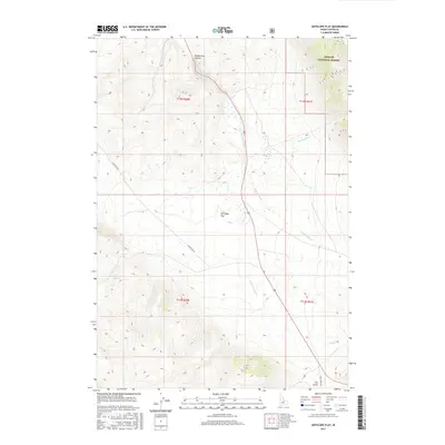
2017 Map of Antelope Flat
USGS Topo · Published 2017About this map
Antelope Flat and the surrounding high-desert terrain of Custer County appear here as they were documented in the late 2010s. The landscape is defined by its drainage systems, most notably Warm Spring Cr which cuts through the central corridor, and Grand View Canyon in the northern reaches. This area is characterized by vast public lands, with a significant portion of the northeast quadrant falling within the Challis National Forest.
Find a feature on this map
16 named features on this map. Tap any name to fly to it.
Don’t see what you’re looking for? This feature index may not catch every label — zoom into the map to look around manually.
Map Details
Editions of this 2017 Antelope Flat Map
This is the sole edition of this map. No revisions or reprints were ever made.
Other maps of this area

1929 · Bayhorse
USGS Topo · 1:125,000

1935 · Borah Peak
USGS Topo · 1:125,000

1938 · Borah Peak
USGS Topo · 1:125,000

1955 · Dubois
USGS Topo · 1:250,000

1956 · Doublespring
USGS Topo · 1:62,500

1957 · Challis
USGS Topo · 1:250,000

1958 · Dubois
USGS Topo · 1:250,000

1960 · Challis
USGS Topo · 1:250,000

1963 · Challis
USGS Topo · 1:250,000
1963 · Little Antelope Flat
USGS Topo · 1:24,000