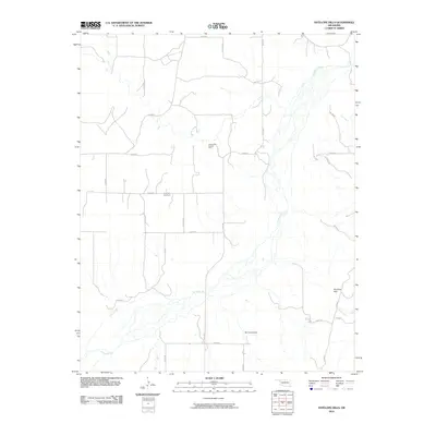
2010 Map of Antelope Hills
USGS Topo · Published 2010About this map
The Canadian River cuts a wide, braided path through this section of Ellis County, defining the landscape's hydrological character as it flows past the namesake Antelope Hills. This region is characterized by an organized grid of rural routes, such as e0740 RD and n1720 RD, which navigate around drainage basins like Oasis Creek and Cottonwood Creek. The presence of the Bishop Gas and Oil Field indicates the industrial utility of the land, contrasting with the quiet isolation of the Lone Tree Cemetery. Local infrastructure is further highlighted by the Bill Sherrill Dam, which manages water resources in an otherwise arid environment. The map captures a moment of transition where traditional ranching or agricultural terrain is shared with energy extraction and small-scale water management projects.
Find a feature on this map
26 named features on this map. Tap any name to fly to it.
Don’t see what you’re looking for? This feature index may not catch every label — zoom into the map to look around manually.
Map Details
Editions of this 2010 Antelope Hills Map
This is the sole edition of this map. No revisions or reprints were ever made.
Other maps of this area

1954 · Perryton
USGS Topo · 1:250,000

1954 · Amarillo
USGS Topo · 1:250,000

1955 · Clinton
USGS Topo · 1:250,000

1955 · Woodward
USGS Topo · 1:250,000

1957 · Clinton
USGS Topo · 1:250,000

1958 · Perryton
USGS Topo · 1:250,000

1958 · Woodward
USGS Topo · 1:250,000

1958 · Amarillo
USGS Topo · 1:250,000

1965 · Crawford
USGS Topo · 1:24,000

1966 · Antelope Hills NE
USGS Topo · 1:24,000