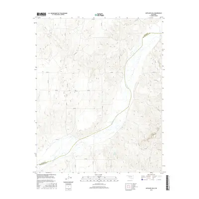
2016 Map of Antelope Hills
USGS Topo · Published 2016About this map
The Antelope Hills rise prominently in the western Oklahoma landscape, defining a rugged boundary between the High Plains and the winding course of the Canadian River. This 2016 survey documents the rural borderlands of Ellis and Roger Mills Counties, where the terrain is marked by deep drainage patterns from waterways like Oasis Creek and Cottonwood Creek. The settlement pattern is sparse, reflecting the ranching and agricultural heritage of the region, evidenced by a network of sectional roads and small-scale water management like the Bill Sherrill Reservoir. A significant point for local history and genealogy is the Lone Tree Cemetery, situated on the plains just west of the river's bend, serving as a quiet landmark of the area's early homesteading families.
Find a feature on this map
27 named features on this map. Tap any name to fly to it.
Don’t see what you’re looking for? This feature index may not catch every label — zoom into the map to look around manually.
Map Details
Editions of this 2016 Antelope Hills Map
This is the sole edition of this map. No revisions or reprints were ever made.
Other maps of this area

1954 · Perryton
USGS Topo · 1:250,000

1954 · Amarillo
USGS Topo · 1:250,000

1955 · Clinton
USGS Topo · 1:250,000

1955 · Woodward
USGS Topo · 1:250,000

1957 · Clinton
USGS Topo · 1:250,000

1958 · Perryton
USGS Topo · 1:250,000

1958 · Woodward
USGS Topo · 1:250,000

1958 · Amarillo
USGS Topo · 1:250,000

1965 · Crawford
USGS Topo · 1:24,000

1966 · Antelope Hills NE
USGS Topo · 1:24,000