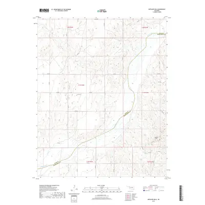
2018 Map of Antelope Hills
USGS Topo · Published 2018About this map
The Antelope Hills rise prominently from the rolling terrain of Western Oklahoma, marking a significant topographical transition south of the Canadian River. This 2018 survey reveals a landscape shaped by the river's winding path as it crosses the county line between Ellis County and Roger Mills County. While the region is defined by its open spaces, human history is grounded in small, localized landmarks like Lone Tree Cem, which sits near E0740 Rd. The map illustrates a grid-like network of secondary roads, such as N1720 Rd and E0730 Rd, providing access to the various sections of this cattle-ranching and oil-producing territory. Tributaries including Oasis Cr and Cottonwood Cr drain the hills, highlighting the vital drainage patterns essential to the local environment and its history of settlement.
Find a feature on this map
35 named features on this map. Tap any name to fly to it.
Don’t see what you’re looking for? This feature index may not catch every label — zoom into the map to look around manually.
Map Details
Editions of this 2018 Antelope Hills Map
This is the sole edition of this map. No revisions or reprints were ever made.
Other maps of this area

1954 · Perryton
USGS Topo · 1:250,000

1954 · Amarillo
USGS Topo · 1:250,000

1955 · Clinton
USGS Topo · 1:250,000

1955 · Woodward
USGS Topo · 1:250,000

1957 · Clinton
USGS Topo · 1:250,000

1958 · Perryton
USGS Topo · 1:250,000

1958 · Woodward
USGS Topo · 1:250,000

1958 · Amarillo
USGS Topo · 1:250,000

1965 · Crawford
USGS Topo · 1:24,000

1966 · Antelope Hills NE
USGS Topo · 1:24,000