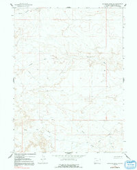
1964 Map of Antelope Knoll NE
USGS Topo · Published 1992About this map
Meadow Springs Wash and Chicken Draw define the drainage patterns across this high desert expanse of Wyoming's Sweetwater County. Surveyed in the early 1960s, the map reveals a landscape primarily dedicated to resource management and utility infrastructure, most notably evidenced by the prominent Pipeline corridor traversing the terrain. The presence of numerous 4wd tracks suggests a remote region navigated largely by industrial or agricultural service vehicles rather than established thoroughfares. To the south, Little Dry Creek winds through the topography, illustrating the ephemeral nature of the local hydrology. This 1964 survey captures the character of the American West during a period of steady infrastructural expansion into its more isolated basins.
Find a feature on this map
7 named features on this map. Tap any name to fly to it.
Don’t see what you’re looking for? This feature index may not catch every label — zoom into the map to look around manually.
Map Details
Editions of this 1964 Antelope Knoll NE Map
2 editions found
Other maps of this area

1954 · Rock Springs
USGS Topo · 1:250,000

1957 · Mc Kinnon Junction
USGS Topo · 1:62,500

1958 · Rock Springs
USGS Topo · 1:250,000

1961 · Little America
USGS Topo · 1:24,000

1961 · Granger
USGS Topo · 1:24,000

1961 · Bryan
USGS Topo · 1:24,000

1962 · Rock Springs
USGS Topo · 1:250,000

1964 · Antelope Knoll NE
USGS Topo · 1:24,000

1964 · Antelope Knoll
USGS Topo · 1:24,000

1964 · Winter Fat Reservoir
USGS Topo · 1:24,000