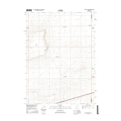
2015 Map of Antelope Spring
USGS Topo · Published 2015About this map
Antelope Spring sits at the northern edge of this high-desert landscape in the Wyoming basin, where the terrain transitions from the low basins of Separation Flats to the more prominent elevations of Windy Hill. The 2015 survey reveals a corridor of activity dominated by modern transportation infrastructure, specifically 80 and 30, which traverse the southern portion of the quadrangle. These routes cross the drainage of Fillmore Cr, providing a vital east-west link through the high plains. The topography is defined by significant draws and landmarks that likely served as navigational waypoints for travelers long before the interstate era, including Windy Point, Mahoney Draw, and Creston Draw. Positioned along the boundary of Sweetwater and Carbon counties, the area reflects the enduring importance of this rugged passage through the continental divide region.
Find a feature on this map
16 named features on this map. Tap any name to fly to it.
Don’t see what you’re looking for? This feature index may not catch every label — zoom into the map to look around manually.
Map Details
Editions of this 2015 Antelope Spring Map
This is the sole edition of this map. No revisions or reprints were ever made.
Other maps of this area

1954 · Rawlins
USGS Topo · 1:250,000

1956 · Rawlins Peak
USGS Topo · 1:62,500

1956 · Bridger Pass
USGS Topo · 1:62,500

1958 · Rawlins
USGS Topo · 1:250,000

1960 · Larsen Knoll
USGS Topo · 1:24,000

1960 · Buck Draw
USGS Topo · 1:24,000

1962 · Rawlins
USGS Topo · 1:250,000

1966 · Jawbone Ranch
USGS Topo · 1:24,000

1966 · Creston Junction
USGS Topo · 1:24,000

1966 · Riner
USGS Topo · 1:24,000