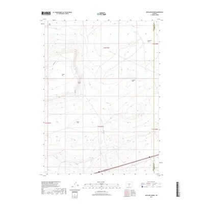
2017 Map of Antelope Spring
USGS Topo · Published 2017About this map
Antelope Spring sits in a high-elevation landscape along the border of Sweetwater and Carbon counties, marking a vital water source in this arid region of Wyoming. The terrain is defined by a series of dry drainages and prominent overlooks, including Buck Draw, Mahoney Draw, and the elevated Windy Point. This 2017 survey by the U.S. Geological Survey captures the modern configuration of the high plains, where the open expanse of Separation Flats meets the winding path of Fillmore Cr in the south. Transportation in the area is facilitated by a mix of major infrastructure and remote access routes, with Interstate 80 cutting across the southern portion of the quadrangle while unpaved tracks like BLM Rd 3203 provide access to the interior. The map illustrates the sparse, utilitarian nature of the landscape, primarily used for grazing and resource management under Bureau of Land Management jurisdiction.
Find a feature on this map
16 named features on this map. Tap any name to fly to it.
Don’t see what you’re looking for? This feature index may not catch every label — zoom into the map to look around manually.
Map Details
Editions of this 2017 Antelope Spring Map
This is the sole edition of this map. No revisions or reprints were ever made.
Other maps of this area

1954 · Rawlins
USGS Topo · 1:250,000

1956 · Rawlins Peak
USGS Topo · 1:62,500

1956 · Bridger Pass
USGS Topo · 1:62,500

1958 · Rawlins
USGS Topo · 1:250,000

1960 · Larsen Knoll
USGS Topo · 1:24,000

1960 · Buck Draw
USGS Topo · 1:24,000

1962 · Rawlins
USGS Topo · 1:250,000

1966 · Jawbone Ranch
USGS Topo · 1:24,000

1966 · Creston Junction
USGS Topo · 1:24,000

1966 · Riner
USGS Topo · 1:24,000