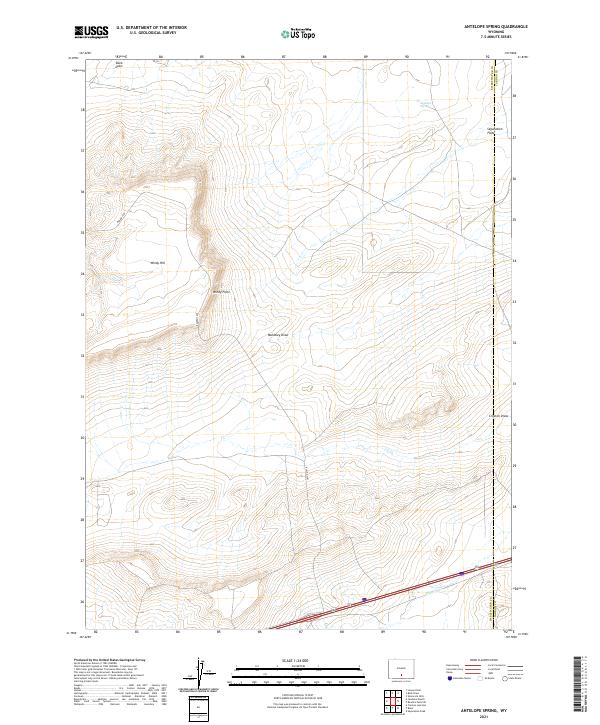
2021 Map of Antelope Spring
USGS Topo · Published 2021About this map
Antelope Spring and Fillmore Cr provide rare water sources in this high-desert landscape situated along the border of Sweetwater and Carbon Counties. The terrain is defined by a series of significant drainage features and topographic landmarks, including the broad Separation Flats and the distinct elevations of Windy Hill and Windy Point. These labels, alongside several dry washes such as Buck Draw, Mahoney Draw, and Creston Draw, illustrate the intricate hydrology of the region. The map captures a modern transportation corridor where the heavy traffic of Interstate 80 and State Route 789 cuts across the southern sections, contrasting with the primitive reach of Blm Rd 3203 that serves the backcountry. This survey offers a clear view of the public land survey system divisions across townships T22N and T21N.
Find a feature on this map
17 named features on this map. Tap any name to fly to it.
Don’t see what you’re looking for? This feature index may not catch every label — zoom into the map to look around manually.
Map Details
Editions of this 2021 Antelope Spring Map
This is the sole edition of this map. No revisions or reprints were ever made.
Other maps of this area

1954 · Rawlins
USGS Topo · 1:250,000

1956 · Rawlins Peak
USGS Topo · 1:62,500

1956 · Bridger Pass
USGS Topo · 1:62,500

1958 · Rawlins
USGS Topo · 1:250,000

1960 · Larsen Knoll
USGS Topo · 1:24,000

1960 · Buck Draw
USGS Topo · 1:24,000

1962 · Rawlins
USGS Topo · 1:250,000

1966 · Jawbone Ranch
USGS Topo · 1:24,000

1966 · Creston Junction
USGS Topo · 1:24,000

1966 · Riner
USGS Topo · 1:24,000