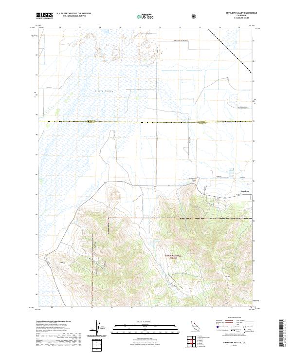
2022 Map of Antelope Valley
USGS Topo · Published 2022About this map
Loyalton sits at the edge of the expansive Sierra Valley, where the valley floor meets the northern reaches of the Tahoe National Forest. This landscape is defined by the sharp transition between the wetland-dotted flats and the rising terrain of Antelope Valley. The mapping of private ranching interests is evident through numerous family-named roads such as Filippini Rd, Genasci Rd, and Bar One Ranch Rd, which cross the marshy valley floor. To the south, the terrain becomes more complex, marked by features like Palen Reservoir and the high point at Lombardi Point. The boundary between Plumas Co and Sierra Co bisects the valley, reflecting the historical importance of this region for agriculture and forestry in the eastern Sierras. Prominent landmarks like Rice Hill and TV Hill provide vertical relief above the canyon systems of Mello Canyon, illustrating the varied topography of this high-altitude basin.
Find a feature on this map
28 named features on this map. Tap any name to fly to it.
Don’t see what you’re looking for? This feature index may not catch every label — zoom into the map to look around manually.
Map Details
Editions of this 2022 Antelope Valley Map
This is the sole edition of this map. No revisions or reprints were ever made.
Other maps of this area

1890 · Sierraville
USGS Topo · 1:125,000

1892 · Sierraville
USGS Topo · 1:125,000

1894 · Sierraville
USGS Topo · 1:125,000

1950 · Chilcoot
USGS Topo · 1:62,500

1950 · Portola
USGS Topo · 1:62,500

1955 · Loyalton
USGS Topo · 1:62,500

1955 · Sierraville
USGS Topo · 1:62,500

1958 · Chico
USGS Topo · 1:250,000

1960 · Chico
USGS Topo · 1:250,000
1972 · Portola
USGS Topo · 1:24,000