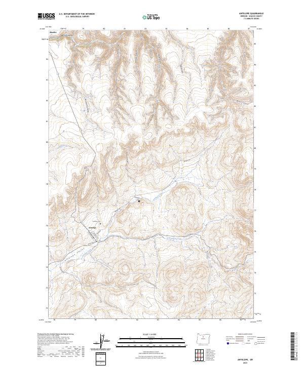
2023 Map of Antelope
USGS Topo · Published 2023About this map
The high desert community of Antelope is centered near the convergence of Antelope Creek and Grub Hollow Creek, where a traditional grid of streets including College St and Union St serves the local population. To the north, the historic rail terminus of Shaniko sits at the edge of Big Pine Hollow, marking a significant point of historical commerce in Wasco County. The geography is defined by the broad Antelope Valley and a series of deeply etched drainages like Laughlin Hollow, Wallace Canyon, and Fraser Canyon. Genealogists will find the Antelope Cem located north of the town center, while those interested in rural infrastructure can trace the path of Bennett Rd as it winds through Johns Canyon and beyond. The landscape is dotted with water sources essential for high-country life, such as Tub Springs and Indian Creek.
Find a feature on this map
26 named features on this map. Tap any name to fly to it.
Don’t see what you’re looking for? This feature index may not catch every label — zoom into the map to look around manually.
Map Details
Editions of this 2023 Antelope Map
This is the sole edition of this map. No revisions or reprints were ever made.
Other maps of this area

1953 · The Dalles
USGS Topo · 1:250,000

1955 · Bend
USGS Topo · 1:250,000

1956 · The Dalles
USGS Topo · 1:250,000

1957 · Bend
USGS Topo · 1:250,000

1957 · The Dalles
USGS Topo · 1:250,000

1958 · Bend
USGS Topo · 1:250,000

1966 · Antelope
USGS Topo · 1:62,500

1966 · Willowdale
USGS Topo · 1:62,500

1970 · Macken Canyon
USGS Topo · 1:24,000
1971 · Bath Canyon
USGS Topo · 1:24,000