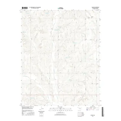
2016 Map of Anthon
USGS Topo · Published 2016About this map
Anthon is the focal settlement in this 2016 survey of Custer County, Oklahoma, situated in a landscape defined by the upper reaches of the Barnitz Creek watershed. This modern topography reveals a sophisticated network of flood control structures, including the Barnitz Creek Site 70 Reservoir and Barnitz Creek Site 32 Reservoir. These man-made water bodies, along with numerous other numbered sites such as Barnitz Cr Site 65 Reservoir, are engineered along the courses of E Barnitz Cr, W Barnitz Cr, and Dry Cr. For genealogists and local historians, the area is meticulously mapped with several significant burial grounds. These include the Anthon Cem near the town site, as well as the Vicksburg Cem, Gyp Cem, and Sare Cem, which provide tangible links to the older community centers and family lineages of this prairie region.
Find a feature on this map
35 named features on this map. Tap any name to fly to it.
Don’t see what you’re looking for? This feature index may not catch every label — zoom into the map to look around manually.
Map Details
Editions of this 2016 Anthon Map
This is the sole edition of this map. No revisions or reprints were ever made.
Other maps of this area

1955 · Clinton
USGS Topo · 1:250,000

1957 · Clinton
USGS Topo · 1:250,000

1957 · Butler
USGS Topo · 1:62,500

1957 · Clinton
USGS Topo · 1:62,500

1962 · Putnam
USGS Topo · 1:62,500

1962 · Aledo
USGS Topo · 1:62,500

1976 · Butler NW
USGS Topo · 1:24,000

1976 · Butler NE
USGS Topo · 1:24,000

1976 · Butler SW
USGS Topo · 1:24,000

1976 · Clinton SW
USGS Topo · 1:24,000