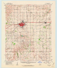
1976 Map of Butler SW
USGS Topo · Published 1976About this map
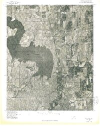
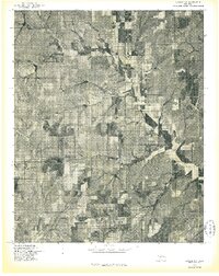
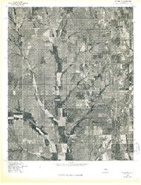
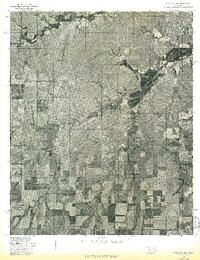
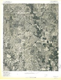
Foss Reservoir dominates the western landscape of Custer County in this 1976 orthophotoquad, showing the intricate shoreline and surrounding land use just years after the reservoir's initial filling. The aerial imagery captures the sharp contrast between the deep waters of the impoundment and the surrounding Oklahoma plains, where agricultural grids and drainage patterns are clearly visible. In the southeastern portion of the map, the Washita River meanders toward the dam, providing a detailed look at the riparian landscape before it was altered by subsequent decades of development. This advance print allows for the study of local topography and watershed management at a specific moment in the mid-1970s.
Find a feature on this map
2 named features on this map. Tap any name to fly to it.
Don’t see what you’re looking for? This feature index may not catch every label — zoom into the map to look around manually.
Map Details
Editions of this 1976 Butler SW Map
This is the sole edition of this map. No revisions or reprints were ever made.
Other maps of this area

1955 · Clinton
USGS Topo · 1:250,000

1957 · Clinton
USGS Topo · 1:250,000
1957 · Butler
USGS Topo · 1:62,500
1957 · Dill City
USGS Topo · 1:62,500
1960 · Hammon
USGS Topo · 1:62,500
1961 · Elk City
USGS Topo · 1:62,500
1976 · Butler NW
USGS Topo · 1:24,000
1976 · Butler NE
USGS Topo · 1:24,000
1976 · Dill City NE
USGS Topo · 1:24,000
1976 · Butler SE
USGS Topo · 1:24,000