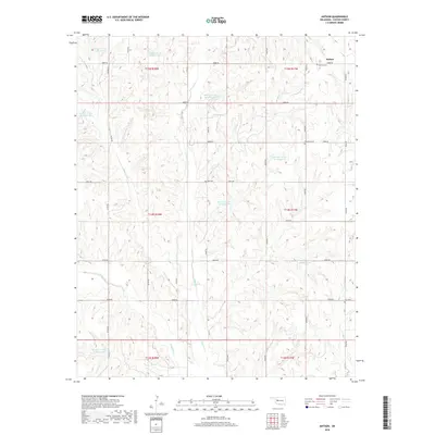
2018 Map of Anthon
USGS Topo · Published 2018About this map
Anthon sits at the northeastern edge of this Custer County landscape, an area defined by a complex network of water management and rural burial sites. The topography is shaped by the drainage patterns of E Barnitz Cr, W Barnitz Cr, and Dry Cr, which feed into numerous localized water control structures such as Barnitz Cr Site 24 Reservoir and Barnitz Cr Site 65 Reservoir. This 2018 survey reveals a landscape partitioned by a precise grid of rural roads, including e0880 RD and n2210 RD, which connect several legacy burial grounds. Genealogists will find interest in the documented locations of Anthon Cem, Vicksburg Cem, Gyp Cem, and Sare Cem, reflecting the early 20th-century community nodes that once populated these Oklahoma plains.
Find a feature on this map
39 named features on this map. Tap any name to fly to it.
Don’t see what you’re looking for? This feature index may not catch every label — zoom into the map to look around manually.
Map Details
Editions of this 2018 Anthon Map
This is the sole edition of this map. No revisions or reprints were ever made.
Other maps of this area

1955 · Clinton
USGS Topo · 1:250,000

1957 · Clinton
USGS Topo · 1:250,000

1957 · Butler
USGS Topo · 1:62,500

1957 · Clinton
USGS Topo · 1:62,500

1962 · Putnam
USGS Topo · 1:62,500

1962 · Aledo
USGS Topo · 1:62,500

1976 · Butler NW
USGS Topo · 1:24,000

1976 · Butler NE
USGS Topo · 1:24,000

1976 · Butler SW
USGS Topo · 1:24,000

1976 · Clinton SW
USGS Topo · 1:24,000