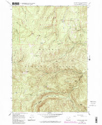
1965 Map of Anthony Butte
USGS Topo · Published 1985About this map
La Grande Watershed dominates the northern reaches of this terrain, a protected landscape of vital resource management within the Whitman National Forest. The map documents a rugged interior geography defined by the high elevations of Anthony Butte and Gorham Butte, where water sources like High Summit Spring and Bear Wallow Spring feed the complex drainage systems of Anthony Creek and Beaver Creek.
Find a feature on this map
42 named features on this map. Tap any name to fly to it.
Don’t see what you’re looking for? This feature index may not catch every label — zoom into the map to look around manually.
Map Details
Editions of this 1965 Anthony Butte Map
3 editions found
Other maps of this area

1901 · Sumpter
USGS Topo · 1:125,000

1953 · Pendleton
USGS Topo · 1:250,000

1955 · Canyon City
USGS Topo · 1:250,000

1956 · Pendleton
USGS Topo · 1:250,000

1959 · Canyon City
USGS Topo · 1:250,000

1965 · Limber Jim Creek
USGS Topo · 1:24,000

1965 · Anthony Butte
USGS Topo · 1:24,000
1965 · Glass Hill
USGS Topo · 1:24,000
1965 · Tucker Flat
USGS Topo · 1:24,000

1965 · Little Beaver Creek
USGS Topo · 1:24,000