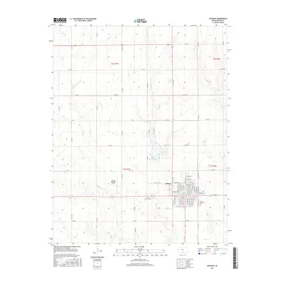
2015 Map of Anthony
USGS Topo · Published 2015About this map
The city of Anthony stands as the primary hub of this Harper County landscape, organized by a dense grid of residential and commercial streets. Just north of the main settlement, Anthony Municipal Lake and Spring Cr provide a central geographic focus, with the Anthony Municipal Airport situated to the west. This 2015 layout reveals a community structured around both its local water resources and its transportation needs, including the extensive municipal street network ranging from N Santa Fe to N LL & G Ave. Outside the town center, the terrain is defined by a series of north-south drainage patterns, including Rush Cr, Bluff Cr, and Beaver Cr. Local history and genealogy are anchored by the presence of Spring Grove Cem and Forest Park Cem, which serve as permanent records of the area's residency and growth through the late twentieth and early twenty-first centuries.
Find a feature on this map
73 named features on this map. Tap any name to fly to it.
Don’t see what you’re looking for? This feature index may not catch every label — zoom into the map to look around manually.
Map Details
Editions of this 2015 Anthony Map
This is the sole edition of this map. No revisions or reprints were ever made.
Other maps of this area

1889 · Anthony
USGS Topo · 1:125,000

1889 · Caldwell
USGS Topo · 1:125,000

1891 · Anthony
USGS Topo · 1:125,000

1893 · Caldwell
USGS Topo · 1:125,000

1897 · Caldwell
USGS Topo · 1:125,000

1955 · Wichita
USGS Topo · 1:250,000

1955 · Pratt
USGS Topo · 1:250,000

1958 · Wichita
USGS Topo · 1:250,000

1959 · Pratt
USGS Topo · 1:250,000
1971 · Bluff City West
USGS Topo · 1:24,000