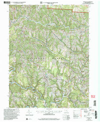
2002 Map of Antioch
USGS Topo · Published 2006About this map
Deeply incised ridges and narrow creek bottoms characterize this portion of the National Forest in Monroe County at the turn of the 21st century. The landscape is defined by its topographic complexity, where narrow divides like Paulas Ridge and Jackson Ridge separate intricate drainage systems such as Cranenest Fork and Dismal Creek. Small communities and rural junctions, including Antioch, Laings, and Mechanicsburg, are positioned primarily along the winding ridge tops or near river bends.
Find a feature on this map
50 named features on this map. Tap any name to fly to it.
Don’t see what you’re looking for? This feature index may not catch every label — zoom into the map to look around manually.
Map Details
Editions of this 2002 Antioch Map
This is the sole edition of this map. No revisions or reprints were ever made.
Other maps of this area

1905 · Clarington
USGS Topo · 1:62,500

1905 · New Matamoras
USGS Topo · 1:62,500

1905 · Woodsfield
USGS Topo · 1:62,500

1906 · New Martinsville
USGS Topo · 1:62,500

1924 · New Martinsville
USGS Topo · 1:62,500

1924 · New Matamoras
USGS Topo · 1:62,500

1926 · New Martinsville
USGS Topo · 1:62,500

1926 · New Matamoras
USGS Topo · 1:62,500

1935 · Clarington
USGS Topo · 1:62,500

1940 · Clarington
USGS Topo · 1:62,500