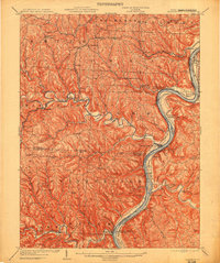
1935 Map of Clarington
USGS Topo · Published 1957About this map
Captina Creek carves a deep, winding valley through the center of this landscape, anchoring a series of small Ohio settlements including Armstrongs Mills, Alledonia, and Steinersville. Industrial activity is evident at the Captina Coal Works near Dorsey, while the transportation network of the mid-1930s shows a mix of active and fading infrastructure. The Wheeling and Western RR is marked as abandoned near Jacobsburg, while the Baltimore and Ohio RR continues to trace the West Virginia side of the Ohio River through Woodlands and Cresap. On the high ridges and in the river bottoms, small rural institutions such as McLain Chapel and Woodland Hill Sch served the scattered agricultural communities. This survey reveals the distinct character of the river border, where narrow floodplains like Round Bottom and Wells Bottom provided rare level ground for settlement against the steep rises of Taylors Ridge and Riggs Knob.
Find a feature on this map
101 named features on this map. Tap any name to fly to it.
Don’t see what you’re looking for? This feature index may not catch every label — zoom into the map to look around manually.
Map Details
Editions of this 1935 Clarington Map
2 editions found
Historical Maps of Moundsville Through Time
3 maps found