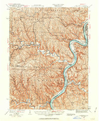
1935 Map of Clarington
USGS Topo · Published 1963About this map
Ohio River commerce and the steep ridges of the Belmont and Monroe border define this 1935 landscape. The riverfront is anchored by the Baltimore and Ohio RR on the West Virginia side and the Cleveland and Pittsburgh Div on the Ohio shore, supporting industrial points like Captina Coal Works and the Kent Clarington Sta. Inland, the terrain is deeply dissected by drainages such as Captina Creek and Sunfish Creek, where small settlements like Armstrongs Mills and Jacobsburg developed along the narrow valley floors.
Find a feature on this map
85 named features on this map. Tap any name to fly to it.
Don’t see what you’re looking for? This feature index may not catch every label — zoom into the map to look around manually.
Map Details
Editions of this 1935 Clarington Map
2 editions found

Other maps of this area

1902 · Wheeling
USGS Topo · 1:62,500

1903 · Littleton
USGS Topo · 1:62,500

1903 · Flushing
USGS Topo · 1:62,500

1904 · Cameron
USGS Topo · 1:62,500

1905 · Littleton
USGS Topo · 1:62,500

1905 · Clarington
USGS Topo · 1:62,500

1905 · New Matamoras
USGS Topo · 1:62,500

1905 · St. Clairsville
USGS Topo · 1:62,500

1905 · Woodsfield
USGS Topo · 1:62,500

1905 · Flushing
USGS Topo · 1:62,500