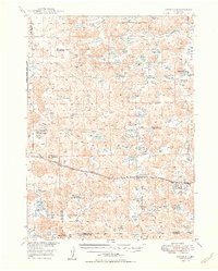
1949 Map of Antioch
USGS Topo · Published 1949About this map
Antioch sits at the heart of this landscape, positioned along the vital transport artery of the Chicago Burlington and Quincy railroad. This 1940s survey reveals a region defined by its alkaline hydrology and ranching economy, where small settlements like Hoffland provided essential links for the potash industry and local cattle operations. The terrain is marked by a dense network of water bodies, including Potash Lake, Jesse Lake, and the peculiar Sewer Lake No 3, many of which were historically significant for mineral extraction. Education and agriculture are deeply intertwined here, evidenced by the distribution of country schools such as School No 128 and School No 102 near established family operations like the Bower Ranch and McFall Ranch. The southern reach of the map is defined by the winding course of Snake Creek, providing a natural drainage for the surrounding sandhills.
Find a feature on this map
43 named features on this map. Tap any name to fly to it.
Don’t see what you’re looking for? This feature index may not catch every label — zoom into the map to look around manually.
Map Details
Editions of this 1949 Antioch Map
2 editions found

Other maps of this area

1896 · Browns Creek
USGS Topo · 1:125,000

1899 · Browns Creek
USGS Topo · 1:125,000

1946 · Berea Creek East
USGS Topo · 1:24,000

1947 · Alliance
USGS Topo · 1:24,000

1947 · Box Butte
USGS Topo · 1:24,000

1948 · Berea Creek East
USGS Topo · 1:24,000

1948 · Alliance
USGS Topo · 1:24,000

1948 · Antioch
USGS Topo · 1:62,500

1948 · Lakeside
USGS Topo · 1:62,500

1948 · Twin Lakes
USGS Topo · 1:62,500