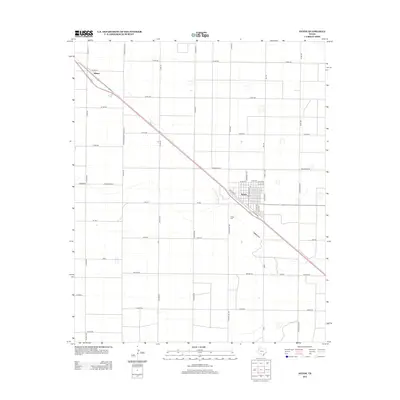
2012 Map of Anton
USGS Topo · Published 2012About this map
Anton and the surrounding plains of Hockley County are characterized by a highly organized grid of rural roads and agricultural fields. This landscape reflects the systematic development of the South Plains, where large-scale farming is facilitated by a network of thoroughfares like Farm-To-Market Road 1072 and FM-597. The settlement of Anton serves as a central hub, with its residential streets including Arnett Ave and Lawrence Ave arranged alongside the regional transit corridor. To the northwest, the map identifies Bainer, a secondary node in the rural transport network. The presence of Anton Cem south of the town center provides a point of continuity for local genealogy, while the naming of corridors like Onion Shed Rd and Fisher Rd hints at the agricultural history and landownership patterns that have shaped this portion of the Texas panhandle over several decades.
Find a feature on this map
44 named features on this map. Tap any name to fly to it.
Don’t see what you’re looking for? This feature index may not catch every label — zoom into the map to look around manually.
Map Details
Editions of this 2012 Anton Map
This is the sole edition of this map. No revisions or reprints were ever made.
Other maps of this area

1954 · Brownfield
USGS Topo · 1:250,000

1957 · Anton
USGS Topo · 1:62,500

1957 · Wolfforth
USGS Topo · 1:62,500

1958 · Brownfield
USGS Topo · 1:250,000

1962 · Brownfield
USGS Topo · 1:250,000

1964 · Littlefield
USGS Topo · 1:24,000

1964 · Lums Chapel
USGS Topo · 1:24,000

1964 · Whitharral
USGS Topo · 1:24,000
1976 · Anton SW
USGS Topo · 1:24,000
1976 · Wolfforth NW
USGS Topo · 1:24,000