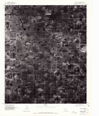
1976 Map of Anton NW
USGS Topo · Published 1978About this map
Spade and its surrounding agricultural grid define this 1976 orthophotoquad of Lamb County, Texas. This specialized survey uses rectified aerial imagery rather than traditional line work, providing a literal view of the High Plains landscape as it appeared in the mid-1970s. The image reveals a highly structured pattern of center-pivot irrigation circles and rectangular cotton fields that dominate the terrain. Unlike standard topographic maps, this orthophotograph allows researchers to see the exact footprint of farmsteads, the texture of the soil, and the precise layout of the small settlement of Spade at the intersection of local roads. It is a stark document of the industrial-scale farming techniques that transformed the Llano Estacado, showing how the land was partitioned and watered during this era of intensive cultivation.
Find a feature on this map
1 named feature on this map. Tap any name to fly to it.
Don’t see what you’re looking for? This feature index may not catch every label — zoom into the map to look around manually.
Map Details
Editions of this 1976 Anton NW Map
This is the sole edition of this map. No revisions or reprints were ever made.
Other maps of this area

1954 · Clovis
USGS Topo · 1:250,000

1954 · Brownfield
USGS Topo · 1:250,000

1957 · Anton
USGS Topo · 1:62,500

1958 · Brownfield
USGS Topo · 1:250,000

1958 · Clovis
USGS Topo · 1:250,000

1962 · Brownfield
USGS Topo · 1:250,000

1962 · Cofferville
USGS Topo · 1:24,000

1962 · Fieldton
USGS Topo · 1:24,000

1964 · Littlefield
USGS Topo · 1:24,000

1964 · Lums Chapel
USGS Topo · 1:24,000