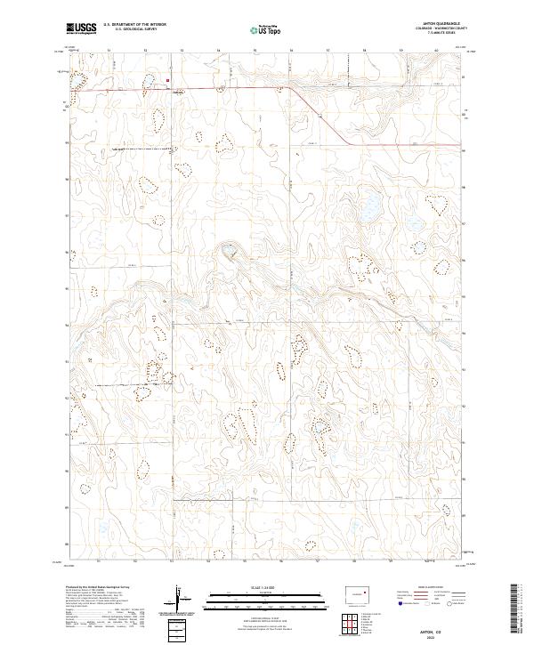
2022 Map of Anton
USGS Topo · Published 2022About this map
Anton sits at the intersection of several primary county roads in this portion of Washington County, serving as a central point for the surrounding agricultural plains. The landscape is defined by the winding path of Gordon Creek, which cuts through the high plains terrain, providing a natural break in the gridded township and range system. This modern survey reflects the enduring section-line road network, including Co RD 8 and Co RD 12, which have historically facilitated the movement of goods and livestock across the Colorado prairie. The map illustrates a sparse, resilient settlement pattern where habitation is concentrated near reliable water sources like Gordon Cr or at key transit junctions, maintaining the traditional character of eastern Colorado's ranching and farming heritage.
Find a feature on this map
21 named features on this map. Tap any name to fly to it.
Don’t see what you’re looking for? This feature index may not catch every label — zoom into the map to look around manually.
Map Details
Editions of this 2022 Anton Map
This is the sole edition of this map. No revisions or reprints were ever made.
Other maps of this area

1954 · Limon
USGS Topo · 1:250,000

1957 · Limon
USGS Topo · 1:250,000

1958 · Limon
USGS Topo · 1:250,000

1973 · Lindon NE
USGS Topo · 1:24,000

1973 · Antelope Creek SE
USGS Topo · 1:24,000

1973 · Shaw
USGS Topo · 1:24,000

1977 · Thurman
USGS Topo · 1:24,000
1977 · Elba SW
USGS Topo · 1:24,000

1977 · Arickaree
USGS Topo · 1:24,000

1977 · Elba SE
USGS Topo · 1:24,000