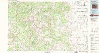
1985 Map of Antonito
USGS Topo · Published 1985About this map
Antonito and the surrounding high-altitude terrain of the San Juan Mountains define this mid-1980s landscape near the Colorado and New Mexico border. The map illustrates a region transitioning from the agricultural expanses of the San Luis Valley in the east to the high wilderness of the San Juan National Forest and Rio Grande National Forest to the west. A notable industrial and historical corridor is visible near the Conejos River, where small settlements like Mogote, Las Mesitas, and Paisaje follow the river's path.
Find a feature on this map
79 named features on this map. Tap any name to fly to it.
Don’t see what you’re looking for? This feature index may not catch every label — zoom into the map to look around manually.
Map Details
Editions of this 1985 Antonito Map
2 editions found
Other maps of this area

1889 · Largo
USGS Topo · 1:250,000

1895 · Largo
USGS Topo · 1:250,000

1905 · San Cristobal
USGS Topo · 1:125,000

1907 · San Cristobal
USGS Topo · 1:125,000

1913 · Summitville
USGS Topo · 1:125,000

1914 · Creede
USGS Topo · 1:125,000

1915 · Summitville
USGS Topo · 1:125,000

1915 · Del Norte
USGS Topo · 1:125,000

1916 · Creede
USGS Topo · 1:125,000

1917 · Del Norte
USGS Topo · 1:125,000