
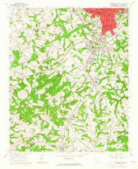
1964 Map of Antreville
USGS Topo · Published 1965About this map
Secession Lake dominates the center of this mid-1960s landscape, its jagged shoreline reaching into the hills of both Abbeville and Anderson counties. The topography illustrates the significant impact of the Rocky River drainage system, which feeds the reservoir and shapes the surrounding ridges. Near the spillway, a powerplant stands as a focal point of local utility and engineering.
Find a feature on this map
27 named features on this map. Tap any name to fly to it.
Don’t see what you’re looking for? This feature index may not catch every label — zoom into the map to look around manually.
Map Details
Editions of this 1964 Antreville Map
This is the sole edition of this map. No revisions or reprints were ever made.
Other maps of this area

1892 · Abbeville
USGS Topo · 1:125,000

1893 · Elberton
USGS Topo · 1:125,000

1948 · Abbeville West
USGS Topo · 1:24,000

1949 · Abbeville
USGS Topo · 1:24,000

1954 · Greenville
USGS Topo · 1:250,000

1958 · Greenville
USGS Topo · 1:250,000

1964 · Iva
USGS Topo · 1:24,000

1964 · Lowndesville
USGS Topo · 1:24,000

1964 · Saylors Crossroads
USGS Topo · 1:24,000
1964 · Anderson South
USGS Topo · 1:24,000