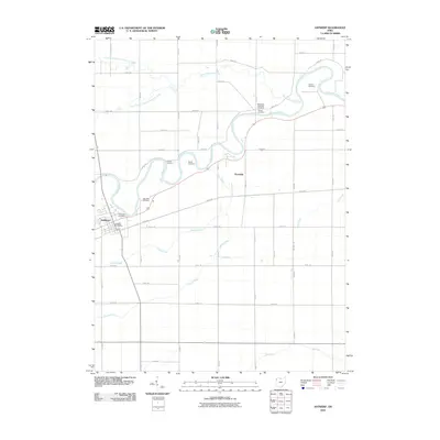
2010 Map of Antwerp
USGS Topo · Published 2010About this map
The Maumee River winds through this Northwest Ohio landscape, defining the character of Paulding County at the start of the 21st century. The settlement of Antwerp sits at a bend in the river, anchored by the Antwerp Post Office and bordered by Riverside Cemetery. The map reveals a high concentration of burial grounds along the river’s path, including Slough Cemetery, Banks Cemetery, and Maumee Cemetery, suggesting the historical significance of the riverbanks for early residents. Further downstream near the community of Knoxdale, the Zuber Cutoff and the Methodist Episcopal Cemetery mark the land. The surrounding area is dominated by a grid of rural roads and numerous waterways such as North Creek, South Creek, and the many branches of Marie DeLarme Creek, reflecting a region deeply tied to its hydrological network.
Find a feature on this map
49 named features on this map. Tap any name to fly to it.
Don’t see what you’re looking for? This feature index may not catch every label — zoom into the map to look around manually.
Map Details
Editions of this 2010 Antwerp Map
This is the sole edition of this map. No revisions or reprints were ever made.
Other maps of this area

1914 · Bryan
USGS Topo · 1:62,500

1914 · Paulding
USGS Topo · 1:62,500

1943 · Bryan
USGS Topo · 1:62,500

1944 · Paulding
USGS Topo · 1:62,500

1953 · Fort Wayne
USGS Topo · 1:250,000

1956 · Fort Wayne
USGS Topo · 1:250,000

1958 · Hicksville
USGS Topo · 1:24,000

1958 · Woodburn North
USGS Topo · 1:24,000

1958 · Woodburn South
USGS Topo · 1:24,000

1960 · Sherwood
USGS Topo · 1:24,000