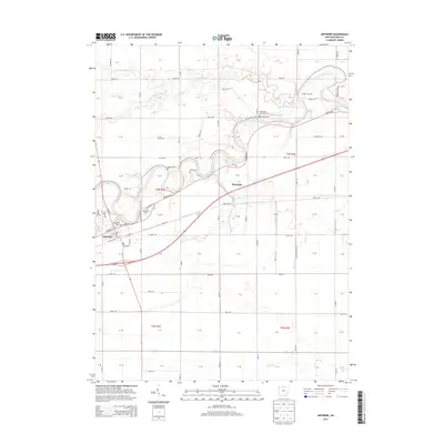
2013 Map of Antwerp
USGS Topo · Published 2013About this map
Antwerp sits along the southern banks of the Maumee River, where the historic path of the Wabash and Erie Canal runs parallel to the waterway through the town center. This landscape is defined by the sharp meanders of the river and the drainage network of Marie DeLarme Cr to the north. The area retains a distinct rural character, with section lines and a grid of rural roads like Road 180 and Road 220 framing the agricultural fields. Family history is well-preserved across the township, marked by numerous burial grounds including Riverside Cem and the Methodist Episcopal Cem. The map traces the transition from the river-and-canal era to the modern road network, highlighting the small settlement of Knoxdale at a significant local intersection east of the main town.
Find a feature on this map
84 named features on this map. Tap any name to fly to it.
Don’t see what you’re looking for? This feature index may not catch every label — zoom into the map to look around manually.
Map Details
Editions of this 2013 Antwerp Map
This is the sole edition of this map. No revisions or reprints were ever made.
Other maps of this area

1914 · Bryan
USGS Topo · 1:62,500

1914 · Paulding
USGS Topo · 1:62,500

1943 · Bryan
USGS Topo · 1:62,500

1944 · Paulding
USGS Topo · 1:62,500

1953 · Fort Wayne
USGS Topo · 1:250,000

1956 · Fort Wayne
USGS Topo · 1:250,000

1958 · Hicksville
USGS Topo · 1:24,000

1958 · Woodburn North
USGS Topo · 1:24,000

1958 · Woodburn South
USGS Topo · 1:24,000

1960 · Sherwood
USGS Topo · 1:24,000