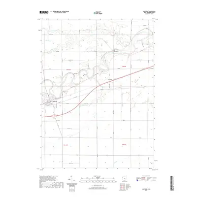
2019 Map of Antwerp
USGS Topo · Published 2019About this map
The Maumee River defines the landscape of northwestern Paulding County, winding past the village of Antwerp. This 2019 survey captures a rural landscape where transportation history remains visible, particularly along the path of Old US Hwy 24 and the village streets of E Canal St and Canal St, which echo the region's historic canal-era roots. The settlement of Knoxdale sits to the east, centered within a network of drainage ditches like Oswalt Ditch and creek systems including Marie DeLarme Cr and N Cr. For genealogists, the map is a dense record of early local history, marking numerous burial sites such as Riverside Cem, Banks Cem, and the Methodist Episcopal Cem. These locations, along with Gordon Cem and Forder Cem, highlight the dispersed nature of the county's early pioneer settlements and church congregations.
Find a feature on this map
77 named features on this map. Tap any name to fly to it.
Don’t see what you’re looking for? This feature index may not catch every label — zoom into the map to look around manually.
Map Details
Editions of this 2019 Antwerp Map
This is the sole edition of this map. No revisions or reprints were ever made.
Other maps of this area

1914 · Bryan
USGS Topo · 1:62,500

1914 · Paulding
USGS Topo · 1:62,500

1943 · Bryan
USGS Topo · 1:62,500

1944 · Paulding
USGS Topo · 1:62,500

1953 · Fort Wayne
USGS Topo · 1:250,000

1956 · Fort Wayne
USGS Topo · 1:250,000

1958 · Hicksville
USGS Topo · 1:24,000

1958 · Woodburn North
USGS Topo · 1:24,000

1958 · Woodburn South
USGS Topo · 1:24,000

1960 · Sherwood
USGS Topo · 1:24,000