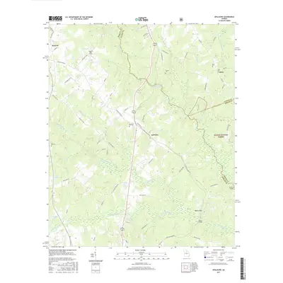
2017 Map of Apalachee
USGS Topo · Published 2017About this map
The Apalachee River and its numerous tributaries, including Big Sandy Creek and Hard Labor Creek, carve a complex drainage pattern through this corner of the Georgia Piedmont. The small communities of Apalachee, Bostwick, and Salem anchor the agricultural and wooded landscape, connected by a network of rural routes like Plantation Rd and Parsonage Rd. This area is rich in family and community history, evidenced by several scattered burial grounds such as Flat Rock Cem, Apalachee Prior Cem, and Thrasher Cem. The eastern portion of the map transitions into the protected lands of the Oconee National Forest, where the terrain drops toward Trimble Bridge. Private aviation is represented by the Southern Oaks Airport near Tap Lake, while local landmarks like Balance Rock and its namesake Balance Rock Lake highlight the unique geological features found within Morgan and Oconee counties.
Find a feature on this map
77 named features on this map. Tap any name to fly to it.
Don’t see what you’re looking for? This feature index may not catch every label — zoom into the map to look around manually.
Map Details
Editions of this 2017 Apalachee Map
This is the sole edition of this map. No revisions or reprints were ever made.
Other maps of this area

1896 · Monroe
USGS Topo · 1:125,000

1953 · Athens
USGS Topo · 1:250,000

1958 · Athens
USGS Topo · 1:250,000

1959 · Athens
USGS Topo · 1:250,000

1963 · Athens
USGS Topo · 1:250,000

1964 · Barnett Shoals
USGS Topo · 1:24,000

1964 · High Shoals
USGS Topo · 1:24,000

1964 · Watkinsville
USGS Topo · 1:24,000

1971 · Rutledge North
USGS Topo · 1:24,000

1972 · Buckhead
USGS Topo · 1:24,000