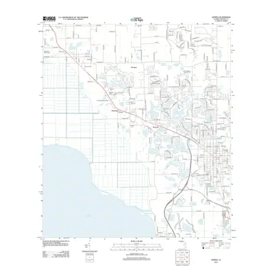
2012 Map of Apopka
USGS Topo · Published 2012About this map
Lake Apopka anchors the southwestern edge of this landscape, its expansive shoreline meeting a complex network of smaller lakes and residential growth. This 2012 survey documents the corridor along US Highway 441, where settlements like Plymouth, McDonald, and Merrimac serve as focal points for the surrounding Orange County communities. The area is marked by a significant concentration of specialized infrastructure, including the Orlando Apopka Airport and the Bob White Field Airport, alongside industrial markers like the Plymouth Lookout Tower.
Find a feature on this map
249 named features on this map. Tap any name to fly to it.
Don’t see what you’re looking for? This feature index may not catch every label — zoom into the map to look around manually.
Map Details
Editions of this 2012 Apopka Map
This is the sole edition of this map. No revisions or reprints were ever made.
Other maps of this area

1955 · Orlando
USGS Topo · 1:250,000

1956 · Winter Garden
USGS Topo · 1:24,000

1956 · Orlando West
USGS Topo · 1:24,000

1957 · Orlando
USGS Topo · 1:250,000

1958 · Orlando
USGS Topo · 1:250,000

1959 · Forest City
USGS Topo · 1:24,000

1960 · Sorrento
USGS Topo · 1:24,000

1960 · Apopka
USGS Topo · 1:24,000

1962 · Orlando
USGS Topo · 1:250,000

1962 · Clermont East
USGS Topo · 1:24,000