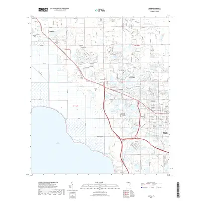
2018 Map of Apopka
USGS Topo · Published 2018About this map
Apopka and its surrounding orange groves and lake systems are documented here during a period of significant suburban expansion. The transition from agricultural roots to a modern logistics and residential hub is visible along the N Orange Blossom Trl corridor, which connects the established centers of Zellwood and Plymouth. This interior Florida landscape is defined by its hydrography, featuring numerous bodies of water like Lake Maggiore, Wolf Lake, and Lake Standish. Significant genealogical and local-history landmarks are well-preserved, including the Zellwood Cem, Greenwood Cem, and Edgewood Cem. The presence of the Orlando Apopka Airport and the engineered McDonald Canal reflect the region's 20th-century infrastructure developments, while the intricate grid of streets in South Apopka shows the residential density near Florida Memorial Park.
Find a feature on this map
73 named features on this map. Tap any name to fly to it.
Don’t see what you’re looking for? This feature index may not catch every label — zoom into the map to look around manually.
Map Details
Editions of this 2018 Apopka Map
This is the sole edition of this map. No revisions or reprints were ever made.
Other maps of this area

1955 · Orlando
USGS Topo · 1:250,000

1956 · Winter Garden
USGS Topo · 1:24,000

1956 · Orlando West
USGS Topo · 1:24,000

1957 · Orlando
USGS Topo · 1:250,000

1958 · Orlando
USGS Topo · 1:250,000

1959 · Forest City
USGS Topo · 1:24,000

1960 · Sorrento
USGS Topo · 1:24,000

1960 · Apopka
USGS Topo · 1:24,000

1962 · Orlando
USGS Topo · 1:250,000

1962 · Clermont East
USGS Topo · 1:24,000