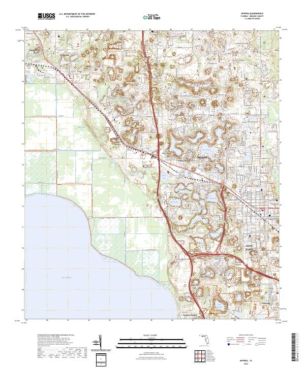
2024 Map of Apopka
USGS Topo · Published 2024About this map
Lake Apopka dominates the western edge of this Orange County landscape, where the McDonald Canal and the Lake Apopka Restoration Area Trl mark a transition between the expansive water body and the surrounding communities. The area is characterized by a high density of named lakes, including Sawdust Lake, Lake Victor, and Lake Eva, which define the residential patterns of Zellwood and Apopka. This survey reveals a complex network of local cemeteries that offer significant value for genealogical research, such as Hampden DuBose Cem and Edgewood-Greenwood Cem. Industrial and transportation hubs are centered around the Orlando Apopka Airport and the settlement of Plymouth, while the southern reaches of the quadrangle transition into South Apopka and Paradise Heights.
Find a feature on this map
132 named features on this map. Tap any name to fly to it.
Don’t see what you’re looking for? This feature index may not catch every label — zoom into the map to look around manually.
Map Details
Editions of this 2024 Apopka Map
This is the sole edition of this map. No revisions or reprints were ever made.
Other maps of this area

1955 · Orlando
USGS Topo · 1:250,000

1956 · Winter Garden
USGS Topo · 1:24,000

1956 · Orlando West
USGS Topo · 1:24,000

1957 · Orlando
USGS Topo · 1:250,000

1958 · Orlando
USGS Topo · 1:250,000

1959 · Forest City
USGS Topo · 1:24,000

1960 · Sorrento
USGS Topo · 1:24,000

1960 · Apopka
USGS Topo · 1:24,000

1962 · Orlando
USGS Topo · 1:250,000

1962 · Clermont East
USGS Topo · 1:24,000