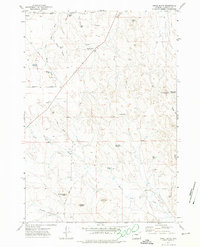
1971 Map of Appel Butte
USGS Topo · Published 1974About this map
Appel Butte and the surrounding high plains of Campbell County are defined here by a network of drainage draws and small-scale livestock water management. This early 1970s landscape shows the transition of the Wyoming prairie into an increasingly managed ranching environment, anchored by features like Schoolhouse Butte and Sassick Butte. The area is interlaced with intermittent waterways such as Bone Pile Creek, Donkey Creek, and Bluegate Creek. These waters feed numerous named stock ponds and small catchments, including the Margaret Sarah Reservoir, Mary Alice Reservoir, and Channey Res. Industrial presence is noted through the north-south pipeline and various drill holes, reflecting the region's energy development history. Infrastructure is sparse, primarily consisting of thoroughfares like Schoonover Road and Bell Road that navigate the draws and ridges.
Find a feature on this map
33 named features on this map. Tap any name to fly to it.
Don’t see what you’re looking for? This feature index may not catch every label — zoom into the map to look around manually.
Map Details
Editions of this 1971 Appel Butte Map
2 editions found
Other maps of this area

1954 · Gillette
USGS Topo · 1:250,000

1955 · Gillette
USGS Topo · 1:250,000

1958 · Gillette
USGS Topo · 1:250,000

1962 · Gillette
USGS Topo · 1:250,000

1971 · Scaper Reservoir
USGS Topo · 1:24,000

1971 · The Gap SW
USGS Topo · 1:24,000

1971 · Gillette East
USGS Topo · 1:24,000

1971 · Oriva
USGS Topo · 1:24,000
1971 · Pleasantdale
USGS Topo · 1:24,000
1971 · The Gap
USGS Topo · 1:24,000