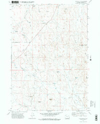
1971 Map of Appel Butte
USGS Topo · Published 1974About this map
Appel Butte and the surrounding high plains of Campbell County are defined by a complex network of water management features and seasonal drainages. During the early 1970s, this landscape was dotted with numerous small reservoirs, including family-named sites like the Margaret Sarah Reservoir and Mary Alice Reservoir, alongside larger works such as the Lake Bed Reservoir. These catchments, along with several recorded drill holes and a prominent Pipeline, illustrate the vital role of water and mineral exploration in this semi-arid ranching country.
Find a feature on this map
28 named features on this map. Tap any name to fly to it.
Don’t see what you’re looking for? This feature index may not catch every label — zoom into the map to look around manually.
Map Details
Editions of this 1971 Appel Butte Map
2 editions found
Other maps of this area

1954 · Gillette
USGS Topo · 1:250,000

1955 · Gillette
USGS Topo · 1:250,000

1958 · Gillette
USGS Topo · 1:250,000

1962 · Gillette
USGS Topo · 1:250,000

1971 · Scaper Reservoir
USGS Topo · 1:24,000

1971 · The Gap SW
USGS Topo · 1:24,000

1971 · Gillette East
USGS Topo · 1:24,000

1971 · Oriva
USGS Topo · 1:24,000
1971 · Pleasantdale
USGS Topo · 1:24,000
1971 · The Gap
USGS Topo · 1:24,000