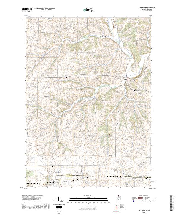
2024 Map of Apple River
USGS Topo · Published 2024About this map
The Wisconsin-Illinois state line divides this northern Illinois landscape, where the settlement of Apple River serves as a primary anchor in Jo Daviess County. The terrain is defined by a series of prominent drainages, including the meandering Pecatonica River and several tributary systems such as Wolf Creek, Trout Brook, and Copper Creek. These waterways have carved distinct features into the topography, most notably Cub Hollow and Salty Hollow, creating a complex network of ridges and valleys that dictate the local road patterns.
Find a feature on this map
53 named features on this map. Tap any name to fly to it.
Don’t see what you’re looking for? This feature index may not catch every label — zoom into the map to look around manually.
Map Details
Editions of this 2024 Apple River Map
This is the sole edition of this map. No revisions or reprints were ever made.
Other maps of this area

1902 · Mineral Point
USGS Topo · 1:125,000

1911 · Elizabeth
USGS Topo · 1:62,500

1923 · South Wayne
USGS Topo · 1:62,500

1936 · Elizabeth
USGS Topo · 1:62,500

1937 · Lena
USGS Topo · 1:48,000

1942 · Lena
USGS Topo · 1:62,500

1943 · Lena
USGS Topo · 1:62,500

1952 · Shullsburg
USGS Topo · 1:24,000

1952 · Calamine
USGS Topo · 1:24,000

1954 · Rockford
USGS Topo · 1:250,000