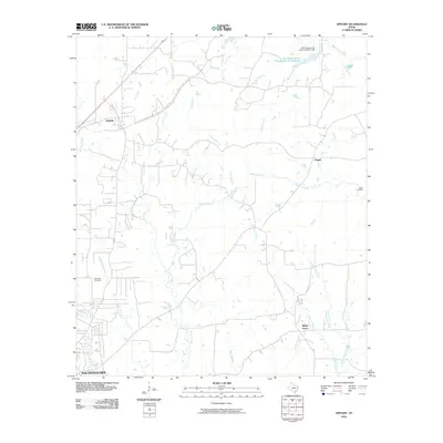
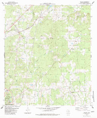
2010 Map of Appleby
USGS Topo · Published 2010About this map
The small community of Appleby serves as the focal point for this landscape in east Texas, where the northern limits of Nacogdoches begin to meet the timbered creek bottoms of the region. The map reveals a rural geography defined by its drainage systems, including the southward-flowing Bayou La Nana and Bayou Carrizo, which carve through the terrain alongside numerous branches like White Oak Branch and Red Branch. Smaller settlements such as Pisgah and Shady Grove are located along secondary roads, providing a view into the residential patterns of the early twenty-first century.
Find a feature on this map
21 named features on this map. Tap any name to fly to it.
Don’t see what you’re looking for? This feature index may not catch every label — zoom into the map to look around manually.
Map Details
Editions of this 2010 Appleby Map
This is the sole edition of this map. No revisions or reprints were ever made.
Other maps of this area

1952 · Nacogdoches
USGS Topo · 1:62,500

1953 · Palestine
USGS Topo · 1:250,000

1957 · Palestine
USGS Topo · 1:250,000

1958 · Martinsville
USGS Topo · 1:62,500

1958 · Timpson
USGS Topo · 1:62,500

1960 · Mount Enterprise
USGS Topo · 1:62,500
1983 · Nacogdoches South
USGS Topo · 1:24,000
1983 · Woden
USGS Topo · 1:24,000
1983 · Nacogdoches North
USGS Topo · 1:24,000
1983 · Appleby
USGS Topo · 1:24,000