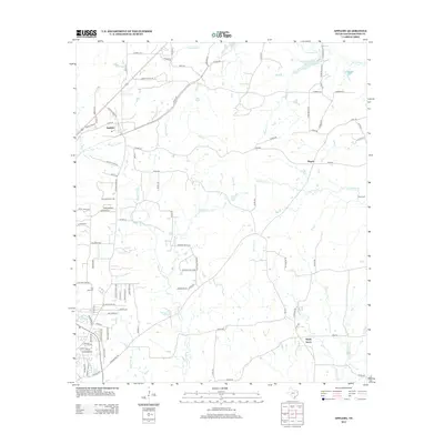
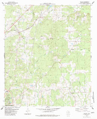
2013 Map of Appleby
USGS Topo · Published 2013About this map
The town of Appleby and its surrounding rural landscapes are defined by an intricate network of creeks and bayous in this part of East Texas. Key water features like Bayou Carrizo, Bayou La Nana, and the sprawling Naconiche Cr carve through the terrain, while the Soil Conservation Service Site 21 Reservoir indicates more modern water management efforts. The map reveals a settlement pattern of small communities including Pisgah and Shady Grove, connected by a web of county roads and state farm-to-market routes like FM-1878. Family and local history researchers will find valuable landmarks such as Moss Cem and Post Oak Cem, alongside dozens of named country lanes. The geography here is a classic representation of the Piney Woods region, where residential clusters like Carrizo Creek Ests began to interface with traditional timber or agricultural lands as the 21st century progressed.
Find a feature on this map
99 named features on this map. Tap any name to fly to it.
Don’t see what you’re looking for? This feature index may not catch every label — zoom into the map to look around manually.
Map Details
Editions of this 2013 Appleby Map
This is the sole edition of this map. No revisions or reprints were ever made.
Other maps of this area

1952 · Nacogdoches
USGS Topo · 1:62,500

1953 · Palestine
USGS Topo · 1:250,000

1957 · Palestine
USGS Topo · 1:250,000

1958 · Martinsville
USGS Topo · 1:62,500

1958 · Timpson
USGS Topo · 1:62,500

1960 · Mount Enterprise
USGS Topo · 1:62,500
1983 · Nacogdoches South
USGS Topo · 1:24,000
1983 · Woden
USGS Topo · 1:24,000
1983 · Nacogdoches North
USGS Topo · 1:24,000
1983 · Appleby
USGS Topo · 1:24,000