Loading...
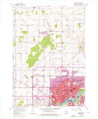
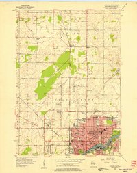
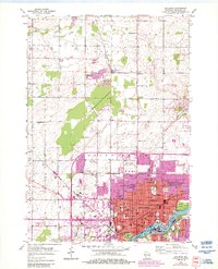
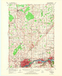
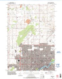
Loading map...1955 Map of Appleton
USGS Topo · Published 1976About this map
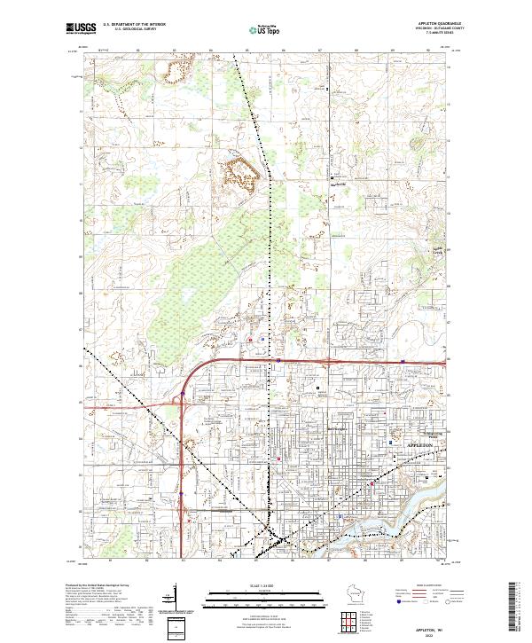
The Fox River anchors this mid-century topographic study of Appleton, showing the city's transition from a rail-dependent industrial center to a growing post-war urban hub. The downtown area is densely packed with educational and civic landmarks including Lawrence College, City Hall, and numerous parochial institutions like St Marys Sch. Outside the urban core, the landscape is defined by the Soo Line and Chicago and North Western railroads, which serviced the surrounding townships of Grand Chute and Center.
Find a feature on this map
56 named features on this map. Tap any name to fly to it.
Don’t see what you’re looking for? This feature index may not catch every label — zoom into the map to look around manually.
Map Details
Date Portrayed1955
Date Published1976
PublisherU.S. Geological Survey
Map TypeTopographic
Scale1:24,000
Physical Dimensions22.5 x 27.32 inches
Editions of this 1955 Appleton Map
3 editions found
Historical Maps of Appleton Through Time
5 maps found
Featured Locations
Source Details
SourceU.S. Geological Survey
CopyrightPublic Domain