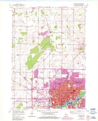
1955 Map of Appleton
USGS Topo · Published 1984About this map
The city of Appleton and its northern outskirts are captured here during a period of significant mid-century growth. Along the Fox River, the urban core is a dense grid of civic and educational life, anchored by Lawrence College and landmarks like City Hall. The purple overprint, added during the 1980s revision, reveals the rapid suburbanization of Grand Chute, extending the residential footprint north toward Northland Avenue.
Find a feature on this map
49 named features on this map. Tap any name to fly to it.
Don’t see what you’re looking for? This feature index may not catch every label — zoom into the map to look around manually.
Map Details
Editions of this 1955 Appleton Map
3 editions found
Other maps of this area

1911 · Neenah
USGS Topo · 1:62,500

1955 · Neenah
USGS Topo · 1:62,500

1955 · Appleton
USGS Topo · 1:24,000

1955 · Appleton
USGS Topo · 1:62,500

1955 · Neenah
USGS Topo · 1:24,000

1955 · Green Bay
USGS Topo · 1:250,000

1956 · New London
USGS Topo · 1:48,000

1961 · Oshkosh
USGS Topo · 1:62,500

1961 · Oshkosh NE
USGS Topo · 1:24,000
1969 · Greenville
USGS Topo · 1:24,000