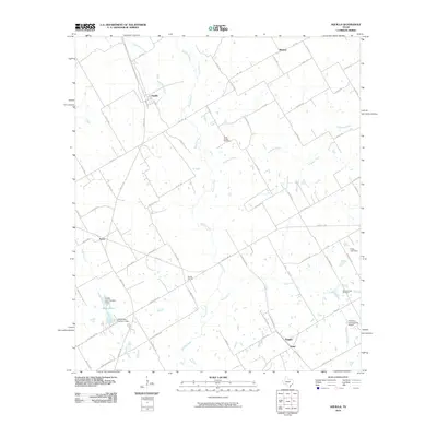
2010 Map of Aquilla
USGS Topo · Published 2010About this map
Aquilla serves as a central hub in this Central Texas landscape, where a network of rural roads connects several small settlements and agricultural landmarks. The terrain is defined by the winding paths of Aquilla Creek, Alligator Creek, and Snake Creek, which drain the open country between Menlow to the north and Tokio to the south. Local industry and agriculture are evidenced by the presence of the County Line Gin, while smaller rural centers like Tyson and Wiggins mark historic crossroads.
Find a feature on this map
70 named features on this map. Tap any name to fly to it.
Don’t see what you’re looking for? This feature index may not catch every label — zoom into the map to look around manually.
Map Details
Editions of this 2010 Aquilla Map
This is the sole edition of this map. No revisions or reprints were ever made.
Other maps of this area

1892 · Waco
USGS Topo · 1:125,000

1920 · Waco
USGS Topo · 1:125,000

1931 · Whitney
USGS Topo · 1:62,500

1931 · Valley Mills
USGS Topo · 1:62,500

1931 · Elm Mott
USGS Topo · 1:62,500

1954 · Waco
USGS Topo · 1:250,000

1955 · Waco
USGS Topo · 1:250,000

1956 · Abbott
USGS Topo · 1:24,000

1956 · West
USGS Topo · 1:24,000
1957 · Aquilla
USGS Topo · 1:24,000